Floodplains
The Floodplain Zoning Ordinance regulates all areas that would be covered by the regional flood or base flood. Lincoln County has been issued official floodplain maps by the DNR and has adopted the Floodplain Zoning Ordinance to administer development within the mapped floodplain. As a consequence, citizens in the community become eligible to apply for Federal flood insurance.
The ordinance is intended to regulate floodplain development to:
- Protect life, health and property
- Minimize expenditures of public funds for flood control projects
- Minimize rescue and relief efforts undertaken at the expense of the taxpayers
- Minimize business interruptions and other economic disruptions
- Minimize damage to public facilities in the floodplain
- Minimize the occurrence of future flood blight areas in the floodplain
- Discourage the victimization of unwary land and homebuyers
- Prevent increases in flood heights that could increase flood damage and result in conflicts between property owners
- Discourage development in a floodplain if there is any practicable alternative to locate the activity, use or structure outside of the floodplain.
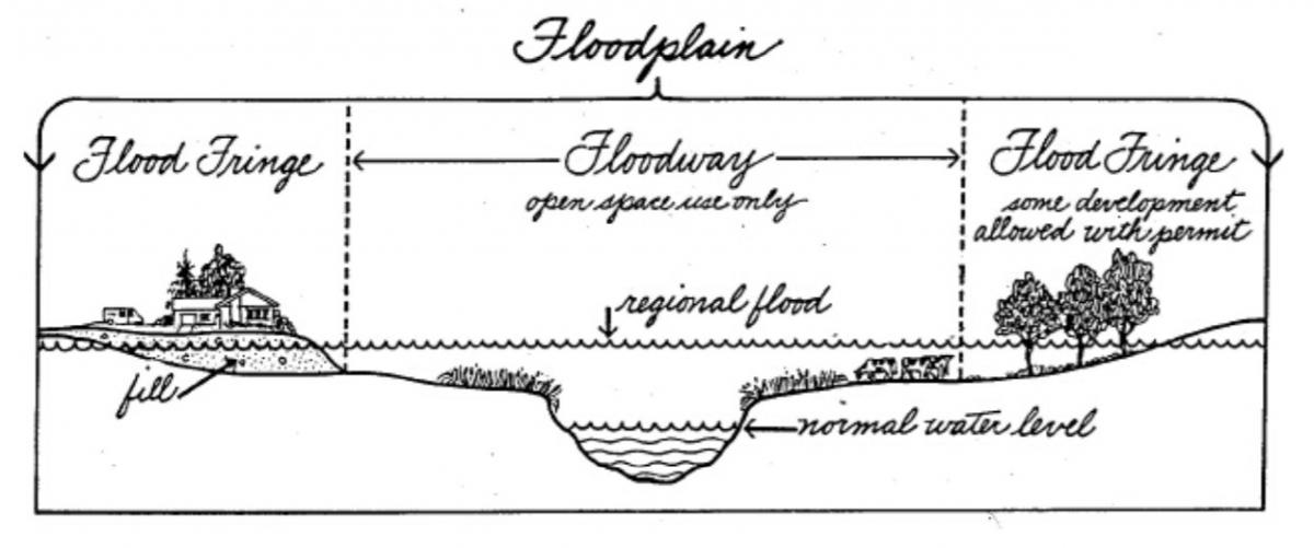
The floodplain consists of lands that are subject to flooding during the regional flood. The floodplain includes floodway and flood fringe zones. Regional flood elevations are calculated by hydraulic models that consider the size of a drainage basin, amount of precipitation and land characteristics. They are also based on evidence of previous flooding.
The floodway consists of the channel of a river or stream, and those portions of the floodplain adjoining the channel that are required to carry the regional flood discharge. The floodway is the most dangerous part of the floodplain. It is characterized by deeper moving water.
The flood fringe is the portion of the floodplain landward of the floodway. It is generally associated with standing water rather than flowing water and with shallower depths.
